RT 508: Geospatial Technologies in Agro-Rural Sector Remote sensing Geographic Information System Geospatial technology
RT508
Course Number & Title: RT508 Geospatial Technologies in Agro-Rural Sector
Course Instructors: Dr. Dipankar Mandal
L-T-P-C: 2-0-2-6
Offered as (Compulsory / Elective): Compulsory
Offered to: MTech and Ph. D programs
Offered in (Odd/ Even / Any): Odd
Pre-Requisite: None
Course Moodle Page
Course Content:
Lecture: Introduction to remote sensing (RS) and spatial data for agriculture: remote sensing of vegetation; Foundations of Aerial/Satellite borne sensing (Optical/hyperspectral/microwave), and spectroscopy. Fundamentals of Geographic Information System (GIS) tools and operations; and spatial data handling-raster and vector data. Geophysical parameter retrievals; GPS fundamentals and CORS network for precision geolocation accuracy; Field data collection-GPS Telemetry and sensor data integration. Post-processing in GIS environment; Remote Sensing and GIS for Development Research. UAV and Satellite based imaging and post-processing; RS-GIS applications in crop inventory mapping, biotic and abiotic stress in plants, and precision farming. RS-GIS for land use mapping, sustainable resources management, watersheds and their management. Land use Land cover change analysis, Change detection with Remote sensing imagery, Accuracy assessment. Understanding the scales (1:50000, 1:10000) for mapping and image interpretation; Land degradation assessment and spatio-temporal data analysis, Digital soil mapping. Web mapping-Geoserver, National geodatabases and query, Web GIS for rural database management and end user application. Spatial planning: Resource Allocation, Network Analysis, Single criteria vs. Multiple criteria, Spatial decision support system and thematic areas (application of multi criteria analysis-MCA/AHP in spatial planning)-Spatial Decision Support System for rural Land Use Planning (SDSS/LUP). Spatial Planning in rural developmental projects: rural healthcare, education, transport connectivity, surface water management, and essential amenities. Applications and examples of RS- GIS for rural development: Selected case studies.
Practical: Scale, topographical maps; GIS and Remote Sensing Image processing; LULC mapping and quality analysis, Spatial analyst and suitability analysis (Spatial MCA). Field survey with GPS units and spatial data logging. Raster and vector data handling in image processing tools: QGIS, SNAP, and customized Python scripts. Assignments, Mini projects and invited industry talk/demonstration in related domain.
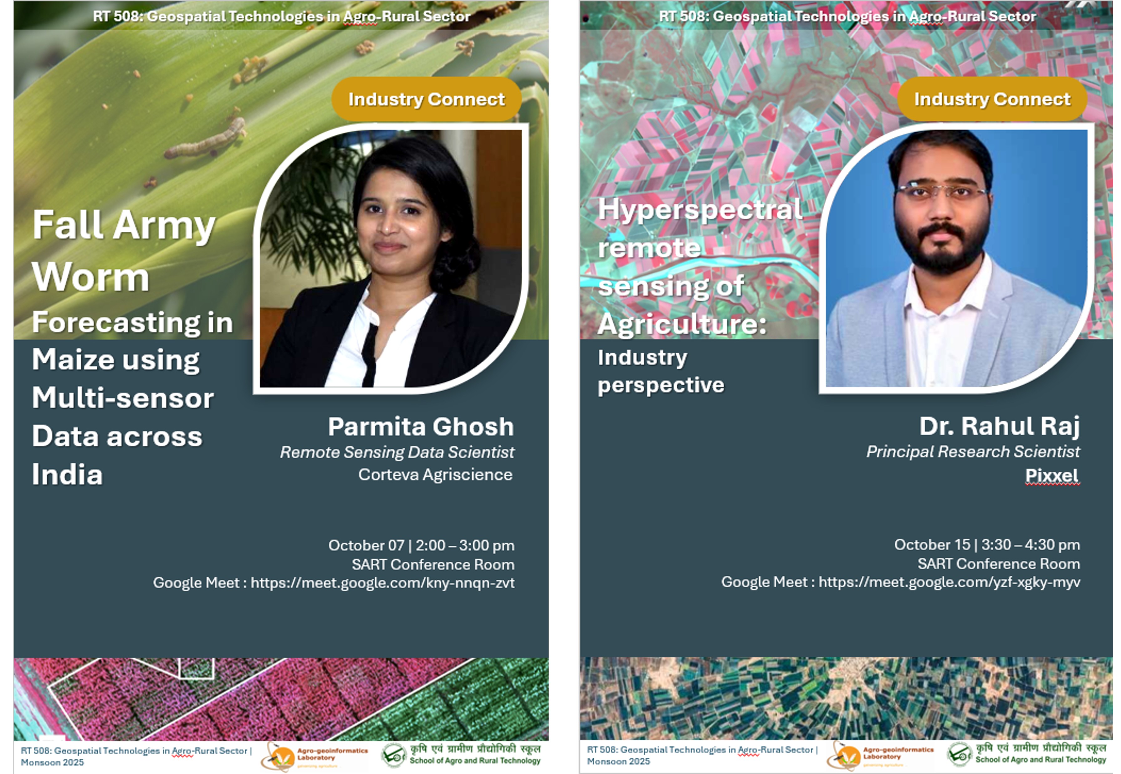
Industry Connect:
Map My Campus Initiative:
Student-led geotagging of campus amenities
Mini-projects:
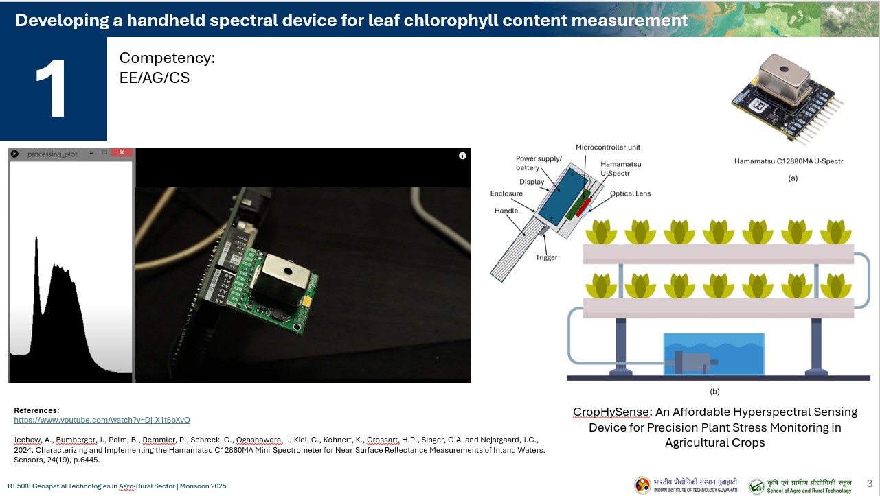
Developing a handheld spectral device for leaf chlorophyll content measurement
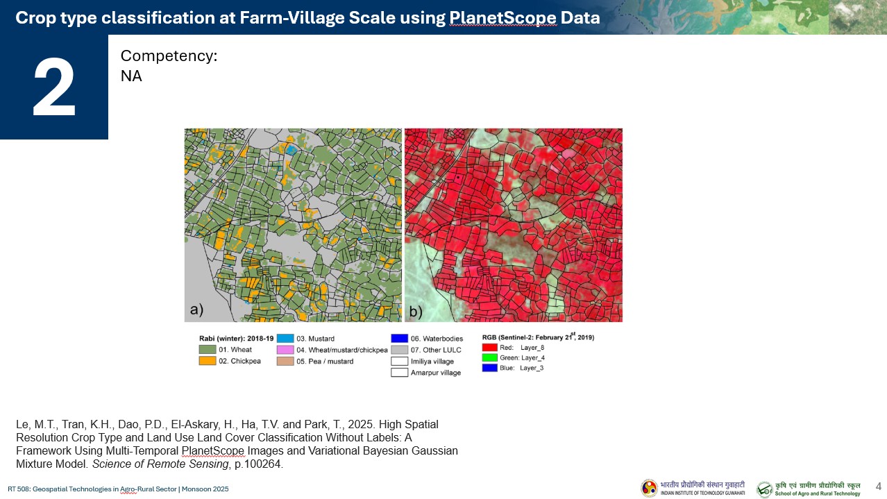
Crop type classification at Farm-Village Scale using PlanetScope Data
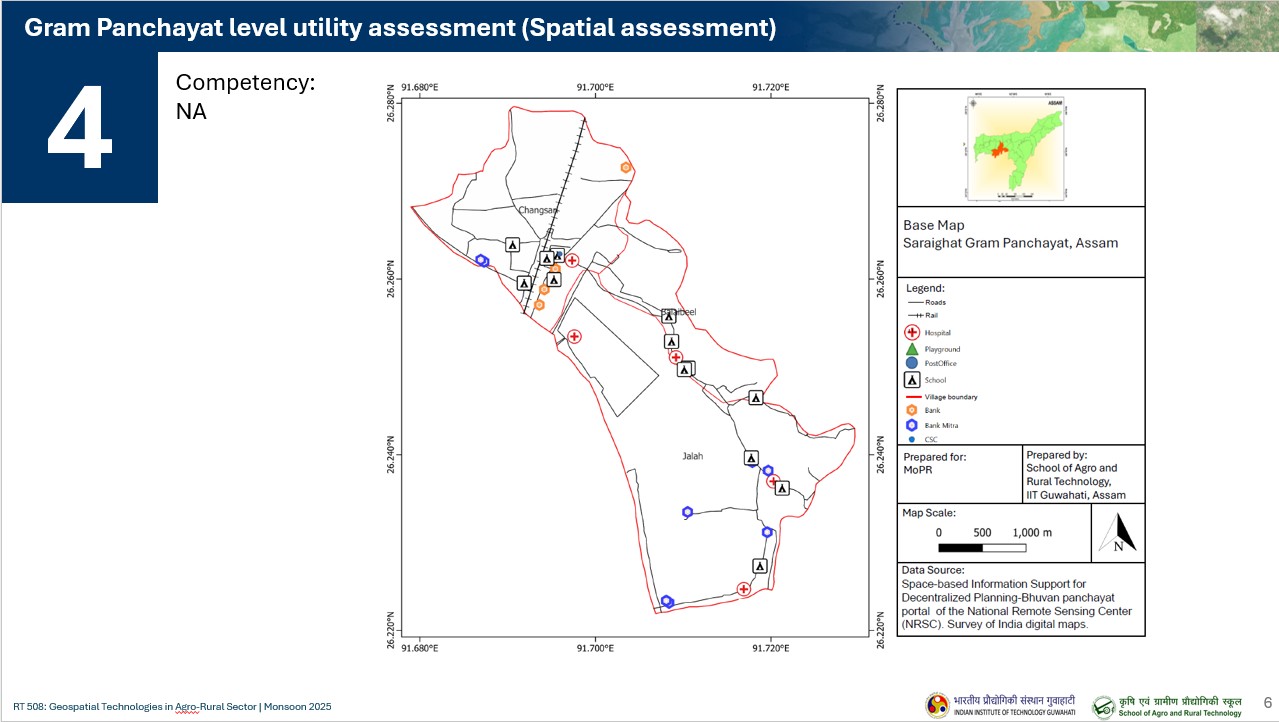
Gram Panchayat level utility assessment (Spatial assessment)
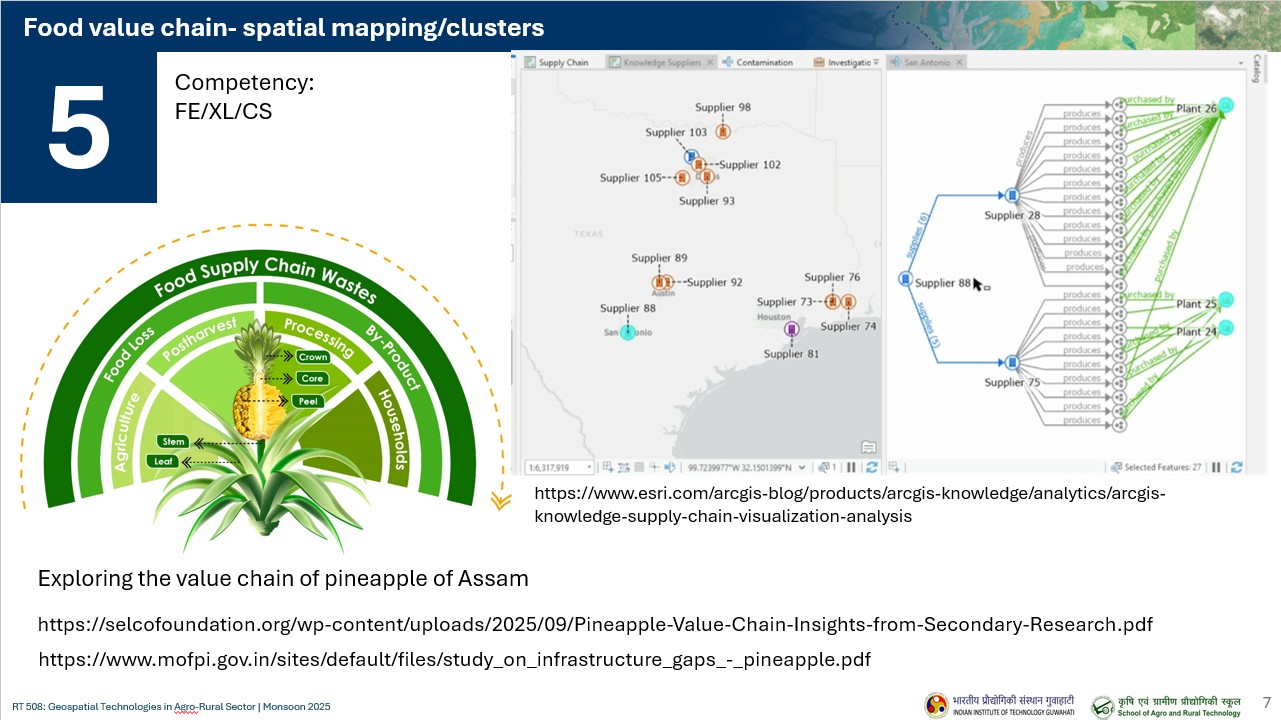
Food value chain- spatial mapping
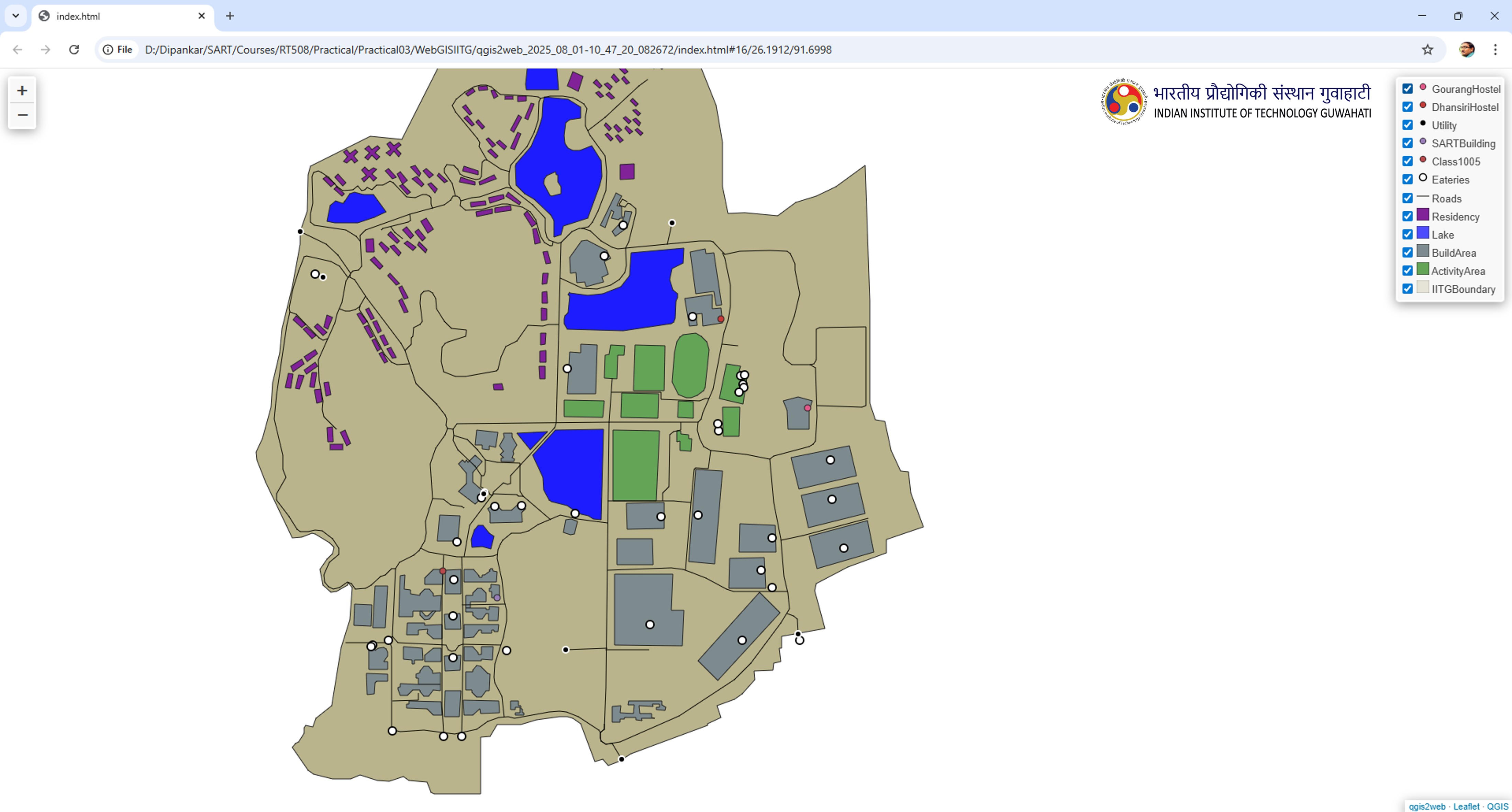
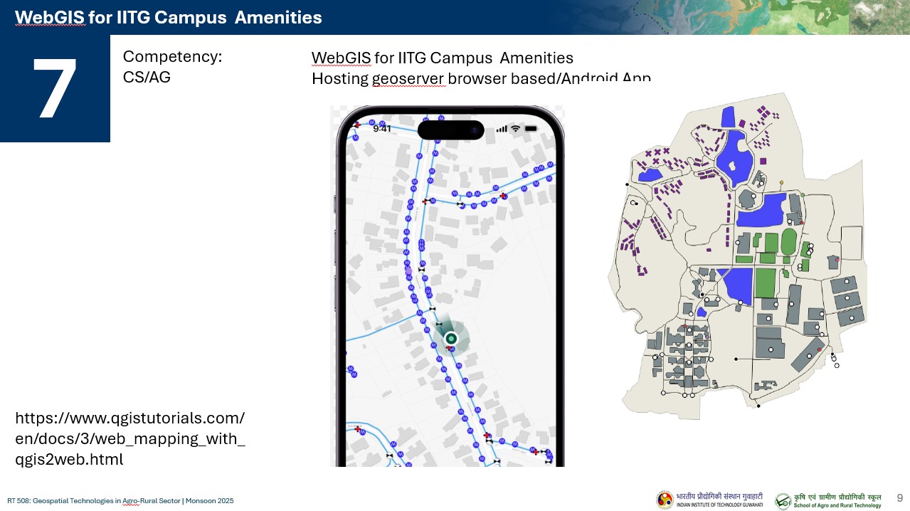
WebGIS for IITG Campus Amenities
Partners and EO-data Agency